
-
Recent Posts
Recent Comments
- Margarita Lappost on Heading Elsewhere for a Better School: Education in Washington Heights
- wdiaz on Less Art and More People: SoHo
- wdiaz on Searching for a Skateboard Haven in Hempstead
- wdiaz on Restaurant Row in Spanish Harlem
- Abel Ramirez on Heading Elsewhere for a Better School: Education in Washington Heights
Archives
Categories
- A.J. Liebling
- Amanda Burden
- Announcements
- Audio
- Backgrounder
- Commentary and Critiques
- Community Services
- Conflict Story
- Deadly Choices at Memorial (Fink)
- E.B. White
- Gish Jen
- Here Is New York
- Joseph Mitchell
- Multimedia
- Neighborhood News
- Neighborhoods
- Profiles
- ProfilesDRAFTS
- Reporting Notes
- Small Business
- Story Queries
- Uncategorized
Meta
Category Archives: Backgrounder
Malverne Backgrounder
Malverne, a one square mile village in southern Nassau County on Long Island, holds an interesting story of its history and residents. According to the 2010 United States Census, the estimated population is around 10,000 that are predominantly Caucasian and a small percentage of minorities.
Previously known as Norwood, resident wonder where the name Malverne derived from. In 1913, Alfred Wagg and Ernest Childs were one of the first residents of Norwood, but according to village records they wanted to change the name to make it a unique place to live. At the time there were many Norwoods in New York State and they rallied residents to submit new names. Childs suggested to name the village after a town he visited and feel in love with in England named Malvern. Residents agreed to the name and added and extra “e” at the end to make it Malverne.
Governed by a Mayor and Board of Trustees this village also has its own police department, fire department, volunteer ambulance corp, historical society and civic association. The main goals of all these departments are to maintain the small town feel within the community. The Malverne Police Department has experienced controversy in the past decade focusing on the high wages and the pay for illegal overtime pertaining to federal holidays. Exposed by Newsday the police chief was forced to resign and John Aresta, was appointed as the new chief. The current mayor is Patricia Ann Norris-McDonald who has the followed the footsteps of her father and former mayor. The Board of Trustees includes Deputy Mayor Joseph Hennessey, Trustee Michael Bailey, Trustee John O’Brien and Trustee Patricia Callahan.
When Malverne was incorporated in 1918 the village was meant to be a place for the Jewish faith, but as time passed different congregations became welcomed in the village. There are many different houses of worship including, Our Lady of Lourdes Roman Catholic Church, Grace Lutheran Church, Bridge Church of the Nazarene, and the International Communion of the Charismatic Episcopal Church. There was a Malverne Jewish Center located Hempstead Avenue, but in 2012 it closed and the Bridge Church took its place. Every year during Thanksgiving all the churches come together a share an ecumenical service, where all the church leaders give sermons to all the residents.
As people stroll down Hempstead Avenue, they will notice the business district of Malverne. Comprised of all small businesses there are a large variety of stores in Malverne from the independent movie theatre to the bakery and to the numerous restaurants. According to the Malverne Merchants and Professional Association, there are over 800 registered businesses in Malverne and this organization helps promote a better business environment and keeping the small town charm within the village. During autumn,both the Malverne Merchants and Professional Association and the Malverne Civic Association work together to organize the annual country fair that many residents look forward to.
The Malverne Civic Association and the Malverne Historical Society are actively involved with the community and host events throughout the year. Wanting create comradely with other residents the Civic Association hosts an annual Getting to Know You function, wine tasting, and assistant the village on their annual Lighting of Malverne. The Historical Society holds their annual holiday gala, which is one of the highlights of the Lighting of Malverne.
Children that reside in Malverne are zoned for either Malverne School District 12 or Valley Stream School District 13. The Malverne School District includes students from Malverne and Lakeview, which is has a large population of African Americans. Many of the Malverne families that reside within District 12 decide to send their children to private elementary schools and high schools. During the 1960’s, as segregation within schools disbanded the Malverne School District was not as easily integrated as others in the area. Newspapers reported the NAACP held marches for integration of the district and explained the extent the Board of Education attempted to do to stop it. Eventually the state mandated that both Whites and Africans American attend the Malverne school district.
This small village is home to one of the last working farms in Nassau County. On the corner of Ocean Avenue and Hempstead Avenue the residents have come to love Grossman’s Farm. During its peak of popularity the hottest commodity was the farm grown corn on the cob. However, once the last Grossman passed away the farm ceased operations and became defunct, until the Nassau County Land Trust purchased the property. In 2012, the farmed changed its name from Grossman’s Farm to Crossroads Farm at Grossman and has continued the tradition of organically grown food for residents and any that stops by.
For prospective buyers Malverne could be an ideal place to start a family with all the necessary amenities nearby. Even though the village offers a lot to its residents, there is one downfall the high taxes. According to the census, it be concluded that this is an affluent community with a median income of $115,000, a poverty rate of 0.7% and nearly 95% of the population attended college or a higher level. Taking every detail together it creates an interesting story of what Malverne is.

Hempstead Avenue – Malverne
South Richmond Hill – Backgrounder
South Richmond Hill, known for its vibrant Indo-Caribbean community and business has become a crossroads for many.

- Murtis or Hindu deities outside a storefront on Liberty Avenue in south Queens.
Once an area that was dominated by Italian-Americans, it has now become a mix of residential homes and apartments with limited backyard and lawn space. One notable portion of housing consists of remodeled homes, while other Indo-Caribbean immigrants have been noted to rent their attics and basements for a little extra income.
The number of illegal immigrants remains indefinite; however using the zip codes to identify census tracts in recent American Community Survey data leaves the number of Asian Indians at approximately 19,000 (this number includes those of south Asian and Caribbean Indian descent.)
The New York Times profiled the emerging immigrant enclave and its colorful businesses in their top five rising immigrant neighborhoods this past April. A slew of businesses in the area are members of the Richmond Hill Economic Development Council, a recent creation of partnerships between long time and new businesses in targeting primarily those of South Asian and Indo-Caribbean heritage.
Small businesses along the area’s prime intersection and hub of community life Lefferts Boulevard and Liberty Avenue, include a variety of outdoor grocery stores, a fish market, sari and Hindu puja shops, roti shops, eateries, real estate and travel agencies, immigration and legal offices, as well as a few franchises such as Dunkin Donuts.
The neighborhood is attached to northern Richmond Hill, comprised of Victorian style homes, located nearby Kew Gardens, along with Ozone Park and South Ozone Park—an area comprised of mainly one or two family residential homes nearby John F. Kennedy Airport. Lefferts Boulevard runs along the entire Richmond Hill area, acting as a prominent intersection for many residents and the A train to Lefferts Boulevard remains the area’s main way of getting to Mahattan.
Jamaica Hospital is the closest hospital to South Richmond Hill and the area houses one major public high school—Richmond Hill High School with a distinctively low graduation rate. In 2012 the high school was given a 7.5 out of possible 20 for student performance from the Department of Education. Separate Community Boards 9 and 10 regulate the district known for its Indo-Caribbean residents and the community is split up into different city council districts as a result of redistricting.
AREA COVERAGE: Mortgage fraud, vibrant culture, real estate and travel agencies, crooked community politicians, and the annual Holi parade have all been reported on by major news publications.
By: Kamelia Kilawan
Woodhaven Backgrounder
As of 2010, the Woodhaven has a total population of 39,684 according to the Census. There is a slight increase from the average 2005-2009 total populations of 39,518 residents.
As of 2010, there are a total of 12,149 households. The highest households make up 21.8% (2,684 households). One of these households is made up of one husband, one wife and no children under 18 years of age.
Regarding its population, the neighborhood is made up of mostly the Hispanics and/or Latinos (55.7%), Caucasians (44.7%), and the Asians (16.5%). Other races such as, Blacks and Native Americans only make up less than 10% of the population.
The current demographic had shifted since the 1990s. Woodhaven was predominantly white, making 82.5% of the roughly 29,122 people that lived in the neighborhood. This may have led to racial tension between the white residents and the incoming Hispanic and/or Latino community.
In terms of gender, the population is split quite evenly as of 2010. The male residents make up 49.4% of the population, and the female residents make up 50.6% of the population.
The population is made up of residents in their early and late 40s (roughly 5.2%), late 20s (5.2%), 30s (roughly 4.9%), and children up to 14 years old (roughly 4.3%).
The highest peak of immigrants that came to Woodhaven was in 1993. During this year, 8.6% (538 people) of the population was immigrants. From then, the immigrant population slowly decreased until 1993, where it rose again to 8.3% (523 people). Again the percentage of immigration decreased until 2001, when it rose back to 8.3%. As of 2002, the immigrant percentage is 7.8% (490 people), which is roughly the same amount.
As of 2003, the total number of business establishments is 408. The total annual payroll is $92,910. The total employment amounts to 2,335. The highest business establishments are held by 1-4 employees. These establishments make up to 74% the total establishments. These business establishments are most likely private owned stores and salons (i.e. 99 Cents/Dollar stores, nail salons, hair salons, etc.).
As of 2003, the highest business sector is retail trade establishments, which makes up 21.4% (87) of the total establishments.
As of 2003, the highest type of dwelling is one-family which makes up 41.9% (2,592) of total land use. Two-family dwelling comes second at 39.4% (2,4,34). The highest number of residential units is 1-4 units (single family), which makes up 99% (5,880) of the total residential units used.
Woodhaven has seen its school enrollment lower throughout the age groups. Comparing census data from 2005-2009 and 2006-2010, the only increases in enrollment in the recent data occur in the 5th-8th grade demographic, and the college demographic. Part of this decrease in enrollment can be attributed to a population trend, as there has been an increase of over 100 10-14 year olds in the recent five-year average, and over 600 more people in the demographic ranges of 18-24.
Another factor to the lower enrollment in primary education in Woodhaven is the lack of adequate schools. In total, there are three public schools, PS 60, PS 97, and the New York City Academy for Discovery, and only one private school, St. Thomas the Apostle.
There is one public library, Queens Public Library located in Forest Parkway. There is one firehouse left in Woodhaven (Engine 293). Last year, Engine 294 had closed despite the neighborhood protests against it. Forest Park is also located in Woodhaven. Forest Park is a popular recreational center made up of roughly 500 acres of land. It was built about 20,000 years ago.
There are currently roughly 126 houses on sale in Woodhaven. The highest priced home is a 5-bedroom, 2.5-bathroom house priced at $999,000. The lowest is priced at $35,000. Of the 126 houses, 6 are in foreclosures.
Regarding community issues, there are plenty in the neighborhood. One is illegal conversion, which consists residents adding extra housing units to a building. This is especially prominent due to the many small businesses cropping up. Another issue is noise pollution. A section of the neighborhood by Jamaica Ave. suffers from the daily comings and goings of the J and Z trains. In addition to that, noises coming from cars and homes are nuisance to the neighborhood, especially to the schools located nearby.
Washington Heights Preliminary Backgrounder
Washington Heights is located in upper Manhattan, from around 157th street to 193rd street. It is located above Harlem and below Inwood, reaching across the borough from the Hudson River to the East River. According to the 2010 census, the total population is around 130 thousand people, spread out across 1.64 square miles of land. The area is very hilly (hence “heights”) and the rivers themselves are bridged by the George Washington to New Jersey and the Washington to the Bronx, hence the name of the neighborhood.
The neighborhood itself is very ethnically diverse, with Latinos (namely Puerto Ricans and Dominicans) taking up the majority of the population and the rest of it being a diverse mix of the rest of the races. The residents are predominantly Christian/catholic, with a few large Catholic churches being in the area. There are many Jewish residents as well, especially because Yeshiva University is located in the upper west end of the Heights. The median income for the majority of the Heights is below the $50k range, aside from the far eastern areas past Broadway, where the population is predominantly White and the median income is in the $80k range. Numerous public schools are located in the area, along with some catholic/private schools but not as many. My elementary school PS 189 is located on the street of the same number, along with the zone middle school a few blocks away and the high school similarly distanced.
Numerous small businesses are located throughout the neighborhood, with the majority of the businesses being small bodegas usually on at least one side of most of the blocks. These stores are at the bottom of the many apartment buildings located in the neighborhood, with more than 90% of the living spaces being occupied by renters rather than owners. Numerous clothing stores and barber shops are also located throughout Washington Heights, along with various fast food chains and small restaurants. The 1 and A/C trains are the subway connections into the area, along with various buses like the M3, M100/101, Bx3, Bx11 and so on. The population of the area at its fringes is shifting, with some stores closing down and people with higher incomes moving in.
Hempstead Backgrounder
The Town of Hempstead is the largest township in the United States at 1,426 square miles. It includes 22 incorporated villages and 50 unincorporated areas. A 2010 consensus recorded a population of 795,757. It would be best to focus on a microcosm of this township; Hempstead Village, or “The Hub.”
Hempstead Village is considerably small at 3.68 square miles but it has a population of 53,891 people, making it the most populated village in New York. Needless to say, the area is congested. As written in The New York Times (2008), the 1960’s construction of Roosevelt Field Mall in Garden City ran shops out of business. CBS Local News recently reported the disdain that Hempstead residents are expressing over a possible expansion of Roosevelt Field and Green Acres Mall.
This gentrification process is taking place in many areas of the township. Supervisor Kate Murray expressed plans for sustainable projects in the Adopted Budget Report for 2013. These projects included bringing construction jobs, solar fueling stations, and a recreational center for special needs kids. Hempstead Village is underrepresented in this vision. Not all of Hempstead is at the forefront of sustainability. The village has other concerns such as gun violence.
Reverend Al Sharpton and the National Action Network organized the Justice for Trayvon Martin Rally, a vigil held in 100 cities. On July 20th people in the community of Hempstead, predominantly clergy members, gathered with a message of “No justice, no peace.” The town also assembled for a peace rally for victims of gun violence.
It is important to take a closer look at the population of Hempstead Village. Within the township, the white race is the highest at 518,756. The total black population is 125,724. Twenty percent of the township’s black population is in Hempstead Village at 26,016. They are the most prevalent race, followed by Latinos at 23,823, Other at 12,284, and whites at 11,788. There is a small population of Asians, Native Americans, and mixed.
According to a 2013 consensus, the median age is 32 which is relatively young. However, a little over half of the population has a high school degree at 65 percent and only 16.5% have a Bachelor’s degree or higher. In 2009, the median household income blacks earned was between 10 and 20 thousand a year while whites earned between 60 and 75 thousand. In 2007, there were 3,594 firms that spanned the 3.8 square miles of the village. There may be a correlation between low motivation for higher education and a high esteem for entrepreneurship.
There is a disparity between the predominant black and Latino populations with males and females in the village. There are 10,945 family houses where 5,311 are husband-wife and 5,634 are considered “other.” The latter group is divided. There are 1,396 homes where there is a male who is without a wife while there are 4,238 homes headed by a female without a husband. It would be interesting to know if that number of single women were mothers raising their families without husbands. There are more Latino males in ratio to females at 13,008 to 10,815. Similarly, there are more black females to males at 14,463 to 11,553. Five percent of the population has remained mixed over the past few years. There may be a cultural bias between the races here with the black population adjusting to the influx of the Latino population. Almost half of the population now has a language other than English spoken in the home.
Posted in Backgrounder
Tagged Backgrounder, Hempstead, Hempstead Village, Nirvani Harriram
1 Comment
Long Island City Backgrounder
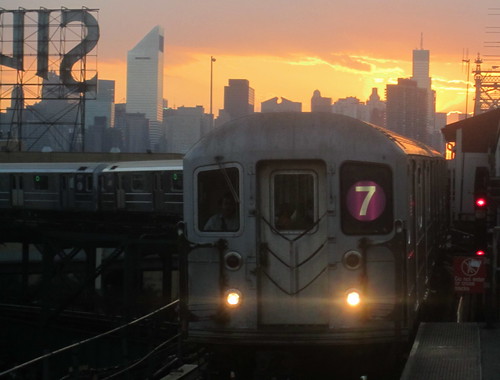
(photo credit: Chris Goldberg)
Located as the East River’s bordering Queens neighborhood, Long Island City is home to a diverse community of businesses and residents. In 1870, LIC was given its name, and became an official neighborhood of New York City just 28 years later in 1898. Well over a century old, the community is now the crossroads of Queens and Manhattan. It’s the first place you’ll arrive in when entering Queens from Manhattan by car, public transit, or if you have the desire to walk over the Queensborough Bridge; and the last Queens location when crossing the river back into Midtown.
Long Island City is home to over 191,000 residents, according to 2010 data collected by the Census Bureau. The same study cites the neighborhood’s ethnic makeup as roughly being 45% Caucasian, 9% African-American, 14% Asian, And 27% Hispanic. It is estimated that there are 80,319 housing units in the particular area.
Located in LIC are a number of public grade schools. There are 13 elementary schools, 5 junior high schools, and 5 high schools. The community is also home to 12 privately run grade schools, and CUNY’s La Guardia Community College. The NYPD’s 114th precinct is the police station that covers the vast neighborhood. L.I.C is also the home of four NYCHA developments: Queensbridge, Woodside, Astoria, and Ravenswoods Houses. Being that Long Island City borders the East River, the majority of NYC’s visitors who arrive by plane at either John F. Kennedy International Airport, or La Guardia Airport pass through the community whether traveling underground through the Subway system, or by car over the 59th Street Bridge.
Silver Cup Studios and Kaufman Astoria Studios are two renown production facilities that are located in LIC. Well known companies such as JetBlue Airways and Steinway & Sons Piano have their corporate offices operating in the heart of Long Island City. Even though these big names operate out of this historical Queens neighborhood, there is still enough room for the hundreds of small businesses and entrepreneurial endeavors that also operate in the same area. Many of them located along the community’s shopping districts, Broadway and Steinway Street.
Posted in Backgrounder
2 Comments
Spanish Harlem Backgrounder
Spanish Harlem is located on the upper east side of Manhattan. Beginning after 96th, Spanish Harlem consists of a high population of Puerto Ricans, followed by Dominicans, and African Americans. As early as 2010, 27% of the population was Puerto Rican, and overall latinos consists of 52% of the population, this is followed by this is followed by 37% African American. The Income level of Spanish Harlem is for the most part considered low, it also has a large concentration of government housing.
Back in the 1980’s Spanish Harlem was known for its large Italian population. Because of World War 2, a wave of Puerto Ricans moved into the area and forced the Italians out, thus creating what is now known as Spanish Harlem. Some of the medical providers in the area consist of the Metropolitan Hospital Center and Mount Sinai Hospital. The Economy consists of mom and pop business owners in retail, as well as many Spanish restaurants that have established themselves for many years and thus survive the invasion of large food chains such as Macdonalds, Burger King, Taco Bell, KFC, Dominos, Papa Johns, Dunking Donuts, and Little Caesars.
There is plenty of transportation in the area, with three train lines, the 4, 5 and 6 lines,As well as a variety of buses, M101, M102, M103, M106, M94, M15, to name a few.
Among some of the major stores in the area, are COSTCOS, Target, Gap, Gamespot, Petsmart, Marshalls and Pathmark. There is also your pharmacies, Rite Aid, Duane Reade, and your local Pharmacy. There is also a New York Sports Club, a Planet Fitness, and a Bally’s Total Fitness. 93% of the apartments are rented, and over 20% of the population lives in government housing. In addition, over 40% of the population in the area receive some form of aid from the government. The asian population has also tripled since the year 2000, it’ll be interesting to see how it affects the latino community and “Spanish” Harlem in general, as more whites move up from downtown searching for cheaper rent and more Asians continue to move into an Area that has been predominantly Latino and African American for the last 30 to 40 years.
-Abel Ramirez
Posted in Backgrounder
1 Comment
Parkchester Community Background
Located in south central Bronx is Parkchester. It is a residential community situated on 121 acres of land and made up of 160 buildings. The complex was built from 1939-1942 and contains about 12,000 apartments. Approximately 40,000-45,000 people call Parkchester home. Parkchester’s website has the median income at around $50,000. According to the Social explorer, out of this population there are about 10,024 apartments that are rented and 2,926 apartments that are owned. There are also about 377 vacant apartments. The neighborhood is fairly diverse. The largest cultural group is Latinos making up 61 percent of the population. The second largest group is Whites comprising about 26 percent. African Americans make up about 20 percent. There have been an increasing number of people of Bangladeshi descent in the community. This cultural group makes up about 15 percent of the population.
Females have a high concentration making up about 52 percent of the population. Males make up about 47 percent. The median age is about 36. People under 18 years old make up about 29 percent of the population. There are seven schools in the area which include PS 106, Bronx Charter School of Excellence, Castle Hill Middle School, St. Helena Elementary School, St. Raymond’s Elementary School, St. Raymond’s Academy for Girls, and St. Raymond’s High School for Boys. There are a total of two Catholic churches, a Baptist church, a synagogue, and two Mosques located in the area.
The neighborhood has a distinct shopping area known as the Yankee Mall. The major stores include Macy’s, Starbucks, Walgreens, Sprint, AT&T, Dress Barnes, Footaction, GameStop, New York and Company, two Chase bank locations, Bank of America, HSBC Bank, Sovereign Bank, Applebees, Ellie’s Diner, Popeye’s, Burger King, Portabella, Rainbows, Radio Shak, Sleepees, Subway, Zales, Payless, Kid’s Place, Children’s Place, Metro Optics, seven bodega’s, six Chinese food restaurants, Domino’s Pizza, Pizza Hut, Little Ceasar’s Pizza, Step Ins Restaurant, A Jewelry store, two cleaners, five supermarkets, 4 barber shops/beauty salons, Blink Fitness, American Beauty School, a record store and a Post Office that service most of the general area in zip code 10462. There is a Carter’s currently being built. Also, the are currently about six vacant commercial locations in the area. The American Theater which has been in the community since its opening in 1943 closed its doors on September 16, 2013. This is the second theater closing in community board 9. Whitestone Cinemas also recently closed down last month.
The community also offers many services to its residents. It has its own security and maintenance forces. It also has the Kid’s bay boys and girls club for it youth. The area is a transportation hub. Parkchester has its own train station on the no. 6 line. It also has several buses that pass through the area such as: the Bx 4 and 4A, the Bx 39, Bx 36, Bx 22, Bx 40, Bx 42, the Q44 and M6 express bus. Despite these amenities, residents that own cars have difficulty finding parking. Other community issues include the closing of businesses that have long been in the community in order to make room for big name stores. Based on the Social Explorer, Parkchester is the start of the more economically affluent side of the Bronx stretching to Throggs Neck. Increasing rent prices is another potential community issue. The quality of education in the community is also a common issue throughout the Bronx and the area.
Williamsburg Backgrounder
North of Williamsburg lies Greenpoint; Bedford-Stuyvesant is to its south, and Bushwick, Ridgewood, and Queens in the east. The East River is to the west of Williamsburg.
The zip codes of Williamsburg residents are11237, 11206, 112t:115%;
There are more homes without children in Williamsburg. 63.9% of the homes in this neighborhood do not have kids and 36.1% do.
Williamsburg is a diverse neighborhood in Brooklyn. Approximately 125,000 people live in Williamsburg. One way that shows its diversity is that the average household income ranges from $20,000 to $90,000.The residents of Williamsburg have easy access to public transportation. Three subway lines ride across the neighborhood including several bus lines. There is also the Williamsburg Bridge that provides commuters access to the city, whether they cross it by train, foot or car.
Because of easy transportation, commuters have reported to have an average of a 34 minute commute
There you can find variety of restaurants, bars, churches and retail shops to catch the attention of any type of person. There is a place for everyone. Many landmarks fill the streets of Williamsburg such as the Continental Army Plaza, the Domino Sugar Refinery and The Kings County Savings Institution.
New condominiums are being built on the coast of Williamsburg that is attracting residents with higher income.
Julie Lasky from The New York Times wrote an article called Mostly True Grit for the Homes and Garden section. In that article she stated, “Today, Williamsburg is the capital of that aesthetic. And many more area shops carry cheeky contemporary design, although the Future Perfect is not one of them. On Monday, Mr. Alhadeff closed his doors, to concentrate on his stores in Manhattan and San Francisco. He leaves behind a neighborhood crammed with color, vibrancy and all manner of covetable objects.” Here Williamsburg is described as a vibrant neighborhood full of life.
Although most people are familiar with the artsy and colorful Williamsburg, there are two sides of this neighborhood. The north part of Williamsburg is a complete opposite to the south. New York Times article The Divided Williamsburg describes it best. “Grand Street is more than just the dividing line between streets that are numbered north and those numbered south. The border has become a Williamsburg’s equivalent of the Mason-Dixon line, cleaving the neighborhood into two: sleek, moneyed “North Williamsburg” and a gritty, hyper-authentic “South Williamsburg”.
The race that dominates the population of “south Williamsburg” is Hispanics, mostly people from Dominican Republic.
Posted in Backgrounder, Neighborhoods
Tagged Brooklyn, Margarita Lappost, Neighborhoods, Williamsburg
1 Comment
Median Income
I thought this map might be helpful:
http://www.wnyc.org/story/174508-blog-census-locates-citys-wealthiest-and-poorest-neighborhoods/
Posted in Backgrounder
Comments Off on Median Income
